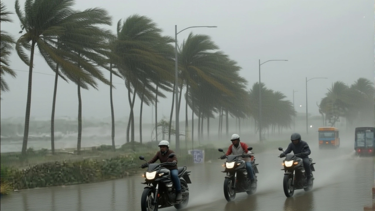
By the time the sun rises on October 28, 2025, Cyclone 'Montha' could be unleashing its full fury along the Andhra Pradesh coastline—winds howling at 110 kilometers per hour, waves crashing over seawalls, and entire neighborhoods without power. The India Meteorological Department (IMD) issued its most urgent warning Sunday night: what began as a deep depression over the Bay of Bengal has rapidly intensified, and by Tuesday morning, it’s expected to be a severe cyclonic storm. This isn’t just another monsoon storm. This is the kind of system that flattens homes, sweeps away fishing boats, and leaves behind a trail of displaced families. And it’s coming fast.
How fast is 'Montha' moving—and why it matters
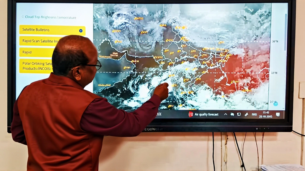
It’s not the wind speed alone that’s terrifying. It’s the pace. Over the past six hours, Cyclone 'Montha' has advanced 18 kilometers per hour toward the coast, a speed that gives residents barely 36 hours to prepare. At 8:30 a.m. on Monday, it was still 830 kilometers southeast of Visakhapatnam, but by Tuesday morning, it’s projected to be just 100 kilometers offshore, weakening slightly before making landfall between Machilipatnam and Kalingapatnam, near Kakinada.
IMD’s latest data shows peak gusts could hit 110 km/h—strong enough to rip corrugated tin roofs off houses, snap utility poles like twigs, and turn street signs into projectiles. Storm surge? Up to one meter. That’s enough to flood low-lying coastal villages that haven’t seen a major cyclone since 2019. Fishermen in Nellore and Srikakulam have been ordered not to go out. Many didn’t need telling. One veteran fisherman, Ramu K., told me over a crackling phone line: “We’ve seen this before. When the sea turns green and the birds vanish, you don’t wait for a warning.”
States on high alert: From Odisha to Kerala
The impact won’t be confined to Andhra Pradesh. The Odisha State Disaster Management Authority has canceled government operations across seven districts, including Ganjam and Puri, where schools and courts are shuttered. The Andhra Pradesh State Disaster Management Authority, led by Managing Director Prakhar Jain, confirmed that rainfall and strong winds have already begun hitting the coast. “The cyclone is not waiting for the forecast to be perfect,” Jain said Monday. “It’s already here.”
Orange alerts—second-highest on India’s four-tier system—are active for Tamil Nadu, Andhra Pradesh, Odisha, and West Bengal. Chennai is bracing for heavy rain and coastal flooding. Even Kerala, far to the southwest, is on edge. Rainfall totals are expected to exceed 200 millimeters in 72 hours across five states. The Indian Army has activated disaster response teams in three zones. Helicopters are being readied for evacuation. Medical supplies are being pre-positioned near Vijayawada and Rajahmundry.
Why this storm is different
What makes Cyclone 'Montha' stand out isn’t just its intensity. It’s the timing. October cyclones in the Bay of Bengal have become more frequent—and more violent—over the last decade. The average sea surface temperature this month is 1.8°C above normal. Warmer water fuels stronger storms. In 2020, Cyclone Nivar hit Tamil Nadu with 120 km/h winds. In 2023, Cyclone Michaung drowned Chennai in three days. Cyclone 'Montha' is following that same, disturbing pattern.
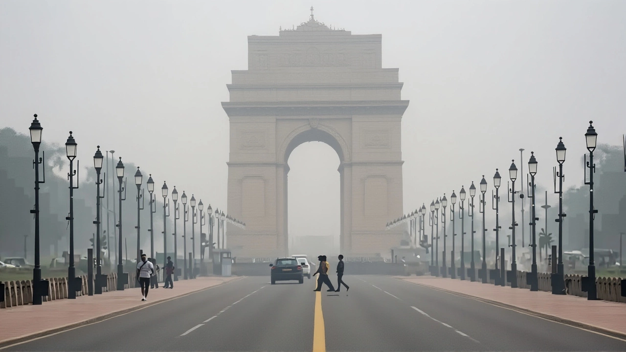
And then there’s the inland ripple. Jharkhand is expecting four straight days of rain starting Tuesday—unusual for this time of year. The moisture is being sucked northward by the cyclone’s circulation. In Delhi NCR, temperatures are already dropping. Residents are pulling out winter coats. “It feels like December,” said a shopkeeper in Ghaziabad. “But it’s still October.”
What’s next: Evacuations, recovery, and the long road
By Tuesday afternoon, emergency shelters in Visakhapatnam and Kakinada are expected to be overflowing. Over 100,000 people are being moved from low-lying areas. Schools, temples, and community centers are being converted into relief hubs. The National Disaster Response Force (NDRF) has deployed 18 teams across the region.
But the real challenge comes after the wind dies down. Power lines will be down. Roads washed out. Saltwater will contaminate wells. The IMD predicts rain will linger through October 30, delaying assessments. Recovery could take months. And with climate models showing warmer oceans becoming the new normal, experts warn: this isn’t a one-off. It’s the new reality.
What you need to know right now
- Stay indoors during peak winds (Tuesday evening through Wednesday morning)
- Avoid flooded roads—just 15 cm of moving water can sweep away a car
- Keep mobile phones charged and have a battery-powered radio
- Do not return to coastal areas until authorities declare it safe
Frequently Asked Questions
How strong is Cyclone 'Montha' compared to past storms?
Cyclone 'Montha' is expected to reach 100–110 km/h peak gusts, placing it in the 'severe cyclonic storm' category—similar to 2023’s Cyclone Michaung but slightly weaker than 2020’s Nivar, which hit 120 km/h. What’s concerning is its rapid intensification: it went from depression to severe storm in under 24 hours, a trend becoming more common as Bay of Bengal sea temperatures rise.
Which areas are most at risk of flooding?
Low-lying coastal zones between Machilipatnam and Kakinada face the highest storm surge risk, with water levels expected to rise 1 meter. Inland, districts like Vizianagaram, Srikakulam, and parts of Odisha’s Ganjam are vulnerable to flash floods from 150–200 mm of rain in 72 hours. Even areas like Warangal and Raipur may see river overflows due to prolonged rainfall.
Why is Delhi experiencing colder weather because of a cyclone in the south?
Cyclone 'Montha' is pulling in massive amounts of moist air from the Bay of Bengal, altering the broader atmospheric pressure pattern. This shift is pushing a cold front from the northwest down into northern India earlier than usual. The result? Delhi NCR is seeing unseasonably cool temperatures and light rain—conditions more typical of December, not October.
What’s the government doing to help?
The Indian Army and NDRF have deployed 18 teams with boats, drones, and medical units. The IMD is issuing hourly updates. Andhra Pradesh and Odisha have opened over 350 shelters with food, water, and sanitation. The central government has released ₹200 crore from the National Disaster Response Fund for immediate relief, with more funds expected if damage assessments confirm widespread destruction.
How long will the rain last after the cyclone passes?
Heavy rain is expected to continue through October 30, especially in Telangana, Chhattisgarh, and Jharkhand, as the cyclone’s remnants move inland. Even after the wind dies down, saturated ground will lead to prolonged flooding and landslides in hilly areas. Officials warn not to assume safety just because the storm has made landfall—residual rainfall is often deadlier than the initial winds.
Is this linked to climate change?
Yes. Studies from the Indian Institute of Tropical Meteorology show Bay of Bengal cyclones have increased in intensity by 25% since 2000, with more systems reaching severe or extremely severe levels. Warmer ocean temperatures—up 1.5–2°C in the past decade—provide more energy for storms to rapidly intensify. Cyclone 'Montha' fits this pattern exactly: fast, fierce, and far more dangerous than similar storms just 15 years ago.